V360° Standard Products

Observations are pulled directly from public weather instrumentation and sensor data. These include METARs from weather observation stations, Mesonet sites, and weather sensors that have been deployed by TruWeather Solutions or the client. Each surface observation has a coloration of red, yellow, or green to denote specific adverse weather conditions that could impact drone flight.
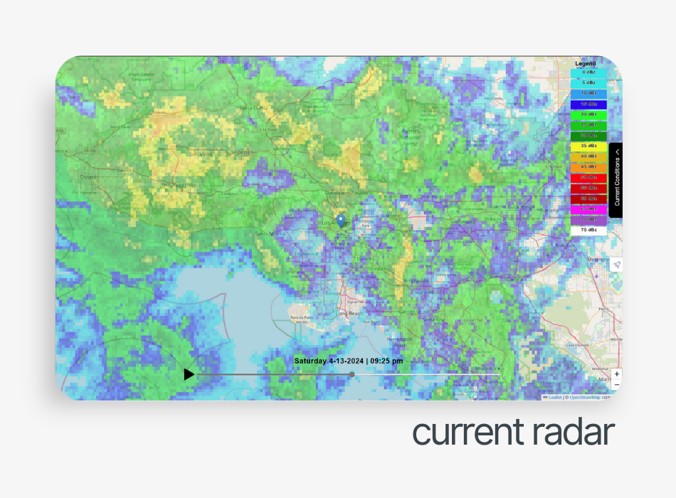
Current Radar gives a timelapse of the mosaic display of reflectivity for the past two hours, namely, to show where precipitation has fallen over and show the prevailing direction of showers/storms. Note: There may be times when weather radar will depict precipitation that is not hitting the ground, or the radar does not display precipitation that is occurring. An operator should always validate whether precipitation is occurring by checking the surface weather observations or the local camera network.
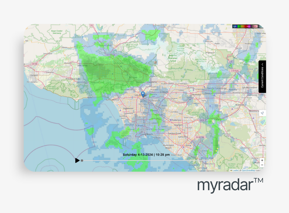
A visualized version of the MyRadar™ application that provides predicted weather movement for the next hour to make real-time operational decisions.
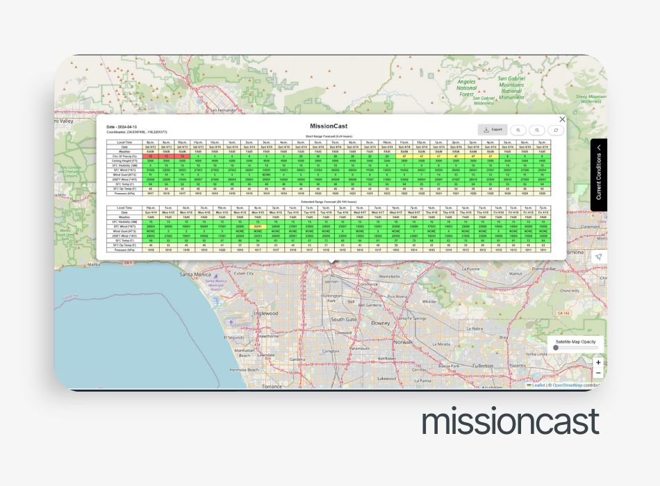
A Go/No-Go mission specific stoplight chart for your designated takeoff and landing, reflecting custom thresholds for the specific airframe and mission. The display includes variables that have a direct effect on drone flight efficiency and safety, including current weather, chance of precipitation, visibility, surface wind, wind gusts, winds aloft, temperature, and dew point. Each specific variable point is optimized for accuracy using a specific blend of microscale and regional models.
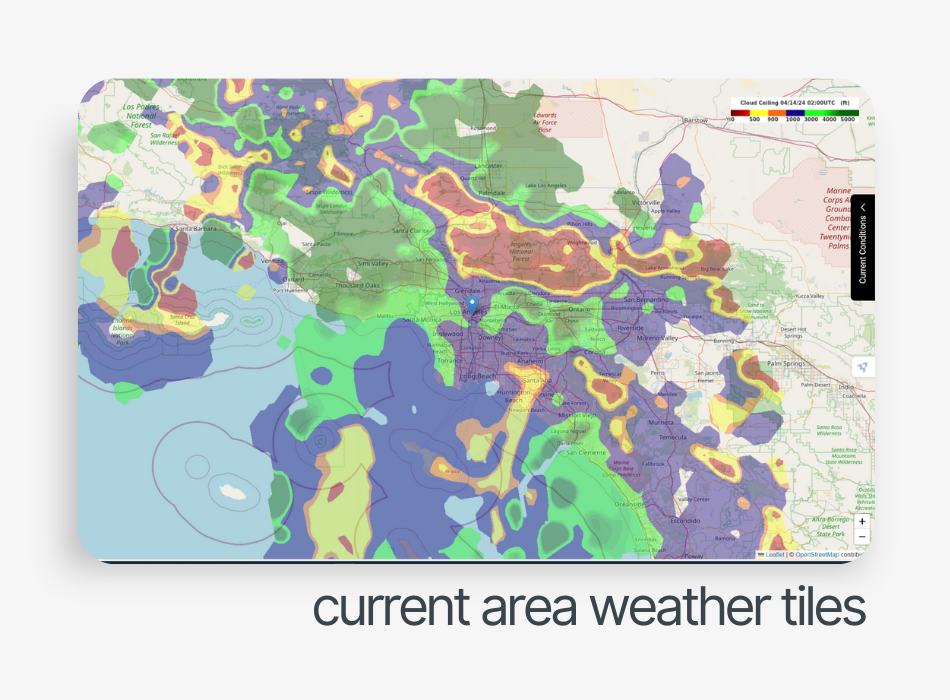
For US, Canada, UK, Central Europe, Middle East (New Zealand and South America coming soon): The weather tile visualization fuses the best data sets from observational and gridded predictions for cloud ceiling heights, visibility, temperature, surface and 80M AGL wind gust, speed and direction. The map output's color coding matches the thresholds set up in your V360 profile.
*These products represent best estimates, and it is recommended that you check real surface observations and the Camera Network.

Toggle located on the right side of the display: Weather reports derived from a blend of real observational data (METAR, Other Weather Observations and Gridded Weather Analysis Algorithms, etc.) merged into one single report to provide the ‘best estimate‘ of the weather relevant to your time and location.
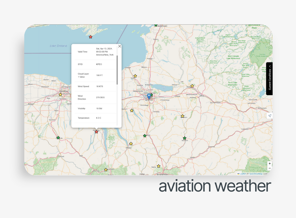
Aviation Weather is a one-stop shop for all pertinent aviation information, including PIREPs, AIRMETs, SIGMETs, METARs, and TAFs. These can provide additional decision insight from official government weather data.
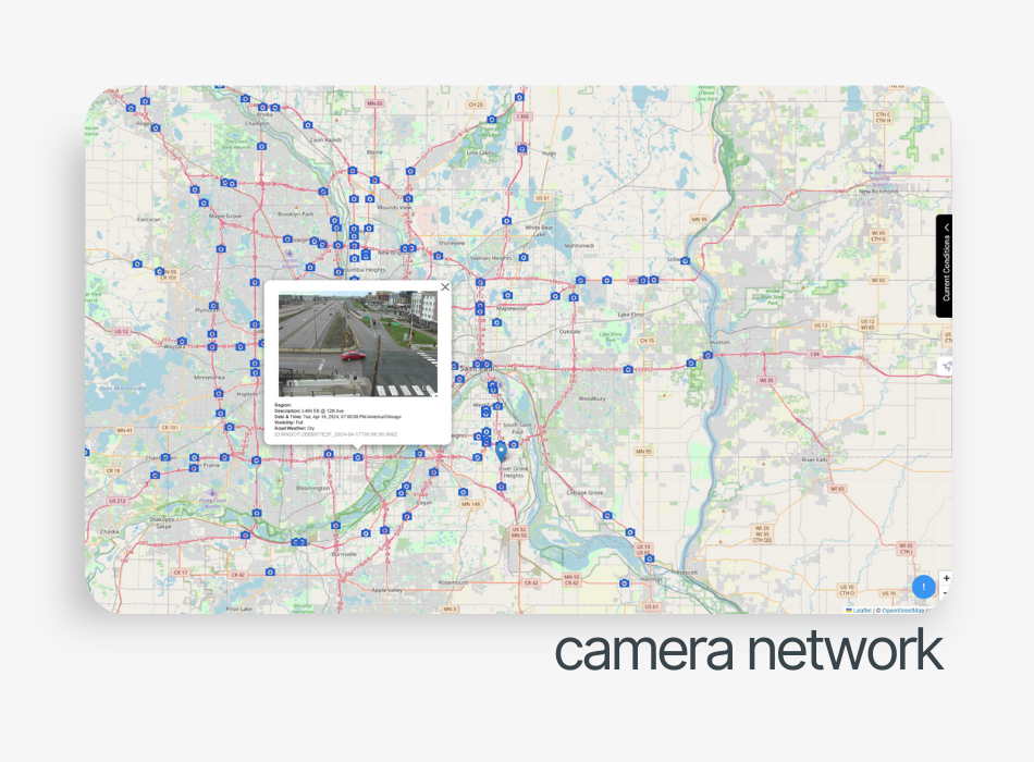
Observations derived by performing analytics on a network of both private and public cameras (CCTV); providing metadata and observation metrics for road conditions, visibility, and precipitation.
V360° Premium Products
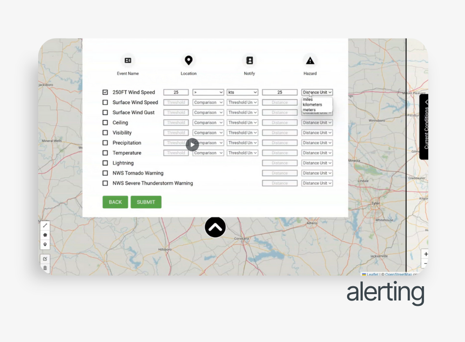
A powerful, real-time weather alerting engine designed to provide ground point and airspace weather alerts customized to user-defined thresholds and distances for specific missions and operations. Parameters includes: ceiling, visibility, surface winds, winds aloft, lightning, and NWS warnings and alerts. If thresholds are surpassed or specific weather events occur, an automated email message will be triggered and promptly sent out.
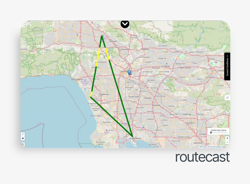
A route evaluation tool: a user provides route waypoints and wind thresholds that impact safety and mission accomplishment and receive custom route data based on end-user defined thresholds with a color-coded risk indicator based on the predicted winds; RouteCAST works in the same way as MissionCAST, pulling the best predictive weather data based on user subscription and resolutions as precise as 1,000 meters where available.
Pricing
Get access to the V360° Weather Workbook
APIs
